Geospatial imagery, experimental tree-crown analysis, land cover and human review
Python
1
1 commits
updated Oct 10, 2026
Acquire imagery. Inspect tree crowns. Export reviewed maps.
ArganEye is a geospatial research workspace for native-resolution imagery, experimental tree-crown detection, human validation and land-cover exploration. It combines Vue 3, Python, PostGIS, object storage and optional model runtimes.
This sanitized source snapshot excludes private pilot imagery, predictions, tree locations, experiment reports and Git history.
Get started · User guide · Documentation · Integrate a model · Contribute · Roadmap · Changelog
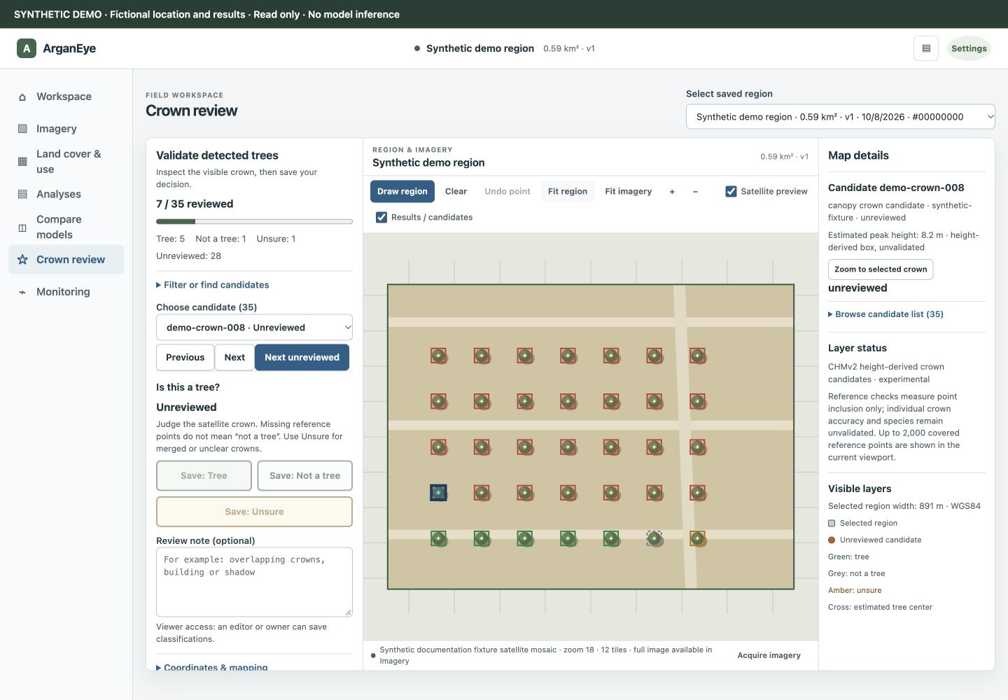
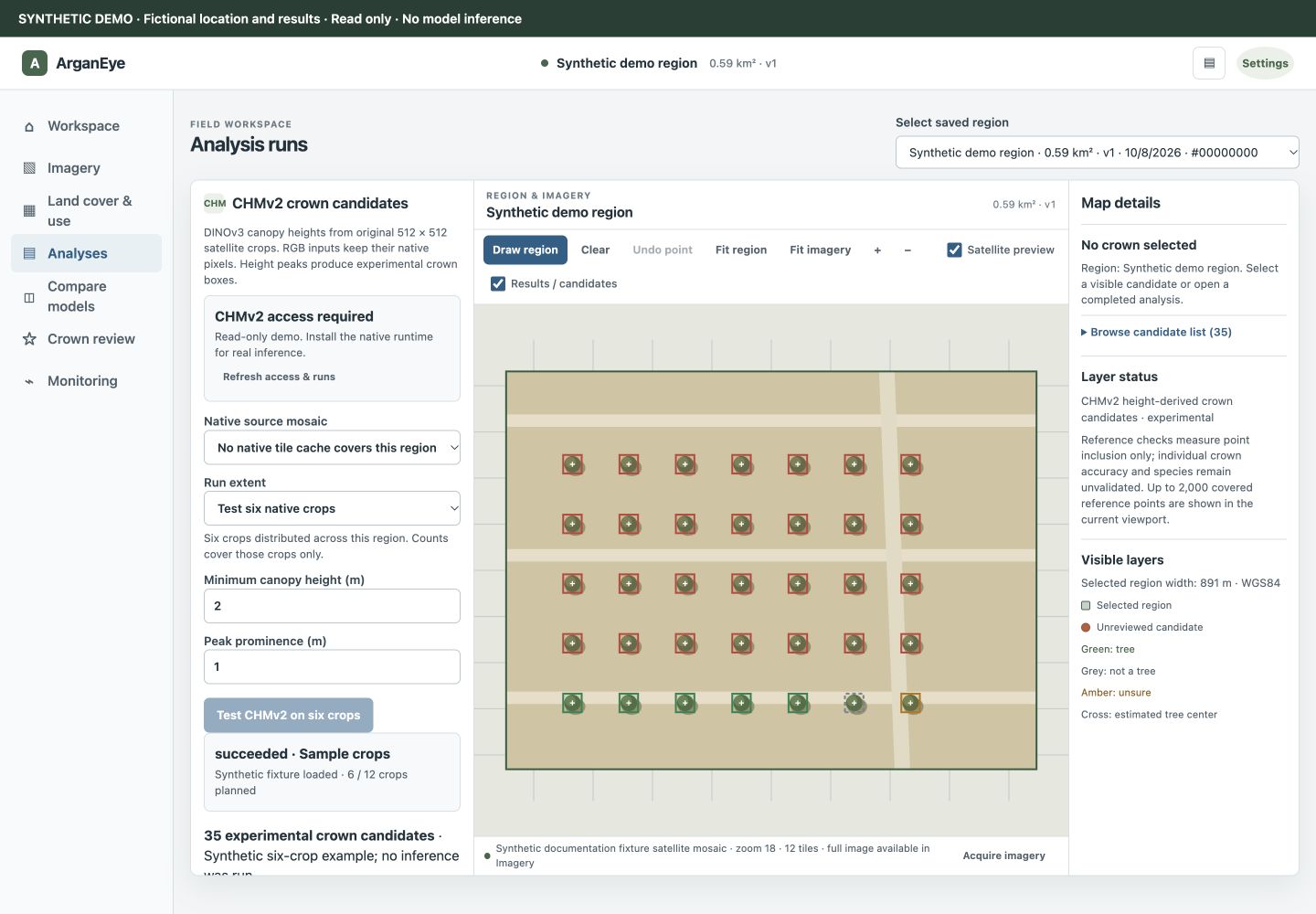
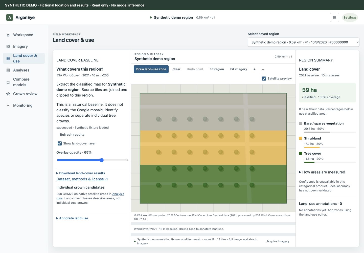
The real Vue interface running against an isolated, read-only synthetic demo. Locations, imagery, heights, counts and decisions in these screenshots are fictional; they are not model-performance evidence or pilot imagery. Reproduce the screenshots.
| I want to… | Read this |
|---|---|
| Explore the interface without imagery credentials or weights | Synthetic demo |
| Run the full local service stack | Compose setup |
| Acquire imagery, run an analysis and review trees | User guide |
| Understand what runs today | Capabilities and runtime limits |
| Change the frontend or backend | Developer setup and architecture |
| Bring a detector, segmenter or raster model | Model integration and expected outputs |
| Fix a problem or propose a feature | Troubleshooting and contributing |
Use Node.js 22 and Python 3.14.8. From the repository root:
npm ci --prefix web
npm run build --prefix web
python3 examples/docs_demo.py
Open http://127.0.0.1:18081/#review. The synthetic demo needs no database, GPU, provider account or model download. It is read only: inference, saving reviews and artifact downloads require the real stack.
For the local platform:
docker compose up --build
Open http://localhost:18080 when /readyz succeeds.
Base Compose does not package the optional CHMv2 runtime, weights or host imagery
cache. See setup profiles before running crown inference.
The agreed pilot is the Admine paper study region near Agadir Al Massira Airport, defined by this ROI. The original airport subset and older map-frame approximation have different footprints.
This is a working research platform, with experimental crown proposals. The pilot has not completed a full-region CHMv2 run or an independent crown/species benchmark. A review decision does not establish species or surveyed trunk accuracy. Incomplete reference points cannot determine false-positive rates. Land cover is a historical 10 m product, not classification of the current RGB mosaic.
Current capabilities · Scientific methods · Distribution notes
Start with CONTRIBUTING.md. The developer guide explains setup and edit locations; the architecture guide separates implemented boundaries from proposed migrations. Model contributors should run the adapter example and inspect the synthetic output samples before changing job contracts.
Testing · Governance · Community expectations · Security reporting
This copy is prepared for outside contributions without internal datasets or history. Public hosting, repository protections and a verified reporting contact remain owner-controlled setup tasks. Readiness checklist.
See CITATION.cff for machine-readable metadata. GitHub's
Cite this repository action provides citation exports once that file is on the
default branch (GitHub documentation).
@software{arganeye,
  author  = {Bouhsine, Taha},
  title   = {ArganEye: Geospatial imagery and tree-crown review},
  version = {0.1.0},
  url     = {https://github.com/mlnomadpy/argan-eye-public}
}
Record the exact Git commit used. 0.1.0 is the declared package version; no
published release is implied. Cite upstream models, datasets and the region paper
separately when used.
Original project code and documentation are MIT licensed. Model weights, provider imagery, datasets, supplied annotations and other third-party assets retain their own terms. The MIT license does not clear their redistribution or training use. The new documentation screenshots use original synthetic fixtures. See licensing and data boundaries before sharing a fork, container, dataset or export.
Geospatial imagery, experimental tree-crown analysis, land cover and human review
Python
1
1 commits
updated Oct 10, 2026
Acquire imagery. Inspect tree crowns. Export reviewed maps.
ArganEye is a geospatial research workspace for native-resolution imagery, experimental tree-crown detection, human validation and land-cover exploration. It combines Vue 3, Python, PostGIS, object storage and optional model runtimes.
This sanitized source snapshot excludes private pilot imagery, predictions, tree locations, experiment reports and Git history.
Get started · User guide · Documentation · Integrate a model · Contribute · Roadmap · Changelog
The real Vue interface running against an isolated, read-only synthetic demo. Locations, imagery, heights, counts and decisions in these screenshots are fictional; they are not model-performance evidence or pilot imagery. Reproduce the screenshots.
| I want to… | Read this |
|---|---|
| Explore the interface without imagery credentials or weights | Synthetic demo |
| Run the full local service stack | Compose setup |
| Acquire imagery, run an analysis and review trees | User guide |
| Understand what runs today | Capabilities and runtime limits |
| Change the frontend or backend | Developer setup and architecture |
| Bring a detector, segmenter or raster model | Model integration and expected outputs |
| Fix a problem or propose a feature | Troubleshooting and contributing |
Use Node.js 22 and Python 3.14.8. From the repository root:
npm ci --prefix web
npm run build --prefix web
python3 examples/docs_demo.py
Open http://127.0.0.1:18081/#review. The synthetic demo needs no database, GPU, provider account or model download. It is read only: inference, saving reviews and artifact downloads require the real stack.
For the local platform:
docker compose up --build
Open http://localhost:18080 when /readyz succeeds.
Base Compose does not package the optional CHMv2 runtime, weights or host imagery
cache. See setup profiles before running crown inference.
The agreed pilot is the Admine paper study region near Agadir Al Massira Airport, defined by this ROI. The original airport subset and older map-frame approximation have different footprints.
This is a working research platform, with experimental crown proposals. The pilot has not completed a full-region CHMv2 run or an independent crown/species benchmark. A review decision does not establish species or surveyed trunk accuracy. Incomplete reference points cannot determine false-positive rates. Land cover is a historical 10 m product, not classification of the current RGB mosaic.
Current capabilities · Scientific methods · Distribution notes
Start with CONTRIBUTING.md. The developer guide explains setup and edit locations; the architecture guide separates implemented boundaries from proposed migrations. Model contributors should run the adapter example and inspect the synthetic output samples before changing job contracts.
Testing · Governance · Community expectations · Security reporting
This copy is prepared for outside contributions without internal datasets or history. Public hosting, repository protections and a verified reporting contact remain owner-controlled setup tasks. Readiness checklist.
See CITATION.cff for machine-readable metadata. GitHub's
Cite this repository action provides citation exports once that file is on the
default branch (GitHub documentation).
@software{arganeye,
  author  = {Bouhsine, Taha},
  title   = {ArganEye: Geospatial imagery and tree-crown review},
  version = {0.1.0},
  url     = {https://github.com/mlnomadpy/argan-eye-public}
}
Record the exact Git commit used. 0.1.0 is the declared package version; no
published release is implied. Cite upstream models, datasets and the region paper
separately when used.
Original project code and documentation are MIT licensed. Model weights, provider imagery, datasets, supplied annotations and other third-party assets retain their own terms. The MIT license does not clear their redistribution or training use. The new documentation screenshots use original synthetic fixtures. See licensing and data boundaries before sharing a fork, container, dataset or export.



