🌊 Coastal Threat Detection System : CodeYatra
A comprehensive AI-powered coastal monitoring and threat detection system that combines satellite imagery analysis, real-time weather monitoring, and flood risk assessment to protect coastal communities.
🚀 Features
🔍 Area of Interest (AOI) Monitoring
- Interactive map drawing for monitoring areas
- AI-powered satellite imagery change detection
- Real-time alerts for coastal changes
- Historical tracking and analysis
🌤️ Live Weather & Storm Monitoring
- Real-time weather data from OpenWeatherMap
- Professional wind visualization with barbs
- Storm tracking and path prediction
- Multiple weather layer overlays
💧 Flood Detection & Risk Assessment
- GPS-based flood risk analysis
- Google Earth Engine integration
- Automated 3-hour monitoring
- Email alerts for high-risk areas
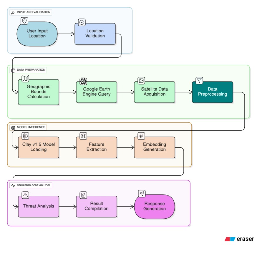
🤖 Overall Detection System (Clay v1.5 Integration)
- Advanced AI-powered coastal monitoring using Clay v1.5 foundation model
- Real-time satellite data processing with Google Earth Engine
- Multi-locations analysis (Mumbai, Kerala, Chennai, Punjab, Bihar, Uttarakhand)
- 768-dimensional embeddings for accurate threat detection
- Progressive scaling (10m-1000m resolution) for comprehensive coverage
- Production-ready API with robust error handling
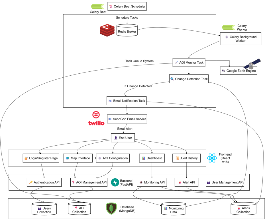
🏗️ System Architecture
Backend (FastAPI + Python)
- FastAPI for high-performance API
- MongoDB for data storage
- Celery for background tasks
- Google Earth Engine integration
- Clay v1.5 foundation model for AI analysis
- Redis for task queuing
Frontend (React + TypeScript)
- React 18 with modern hooks
- TypeScript for type safety
- Leaflet for interactive mapping
- Tailwind CSS for styling
- Real-time data updates
📸 System Screenshots
Flood Alert Email
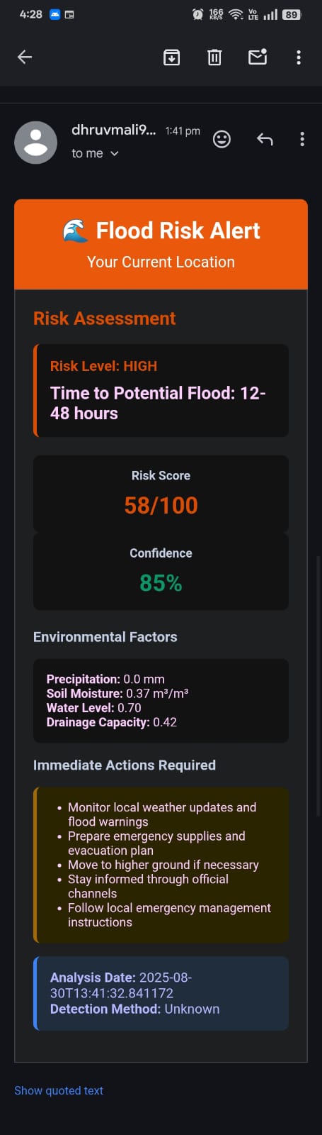 Flood Prediction
HeatMap
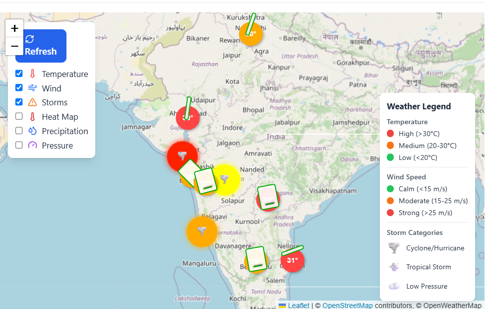 Cyclone map
Before Analysis - Coastal Area
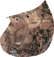 Coastal area before change detection analysis
After Analysis - Detected Changes
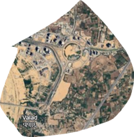 Coastal area after change detection with highlighted modifications
🔮 Future Implementations
- Custom DL pipeline for anomaly and algal blooms detection
- Enhanced Clay v1.5 model fine-tuning for coastal-specific features
- Multi-temporal analysis for long-term coastal change trends
- Advanced early warning system with predictive modeling
- Current custom pipeline for Shoreline detection and monitoring which can be viewed at ./Models/fetch_noaa_data.py and test_flood_detection
- Data API From https://www.noaa.gov/ocean-coasts
🚀 Quick Start
Prerequisites
- Python 3.8+, Node.js 16+, MongoDB, Redis
- Google Earth Engine account
- OpenWeatherMap API key
Backend Setup
cd backend
python -m venv venv
source venv/bin/activate
pip install -r requirements.txt
python main.py
Frontend Setup
cd frontend
npm install
echo "VITE_OPENWEATHER_API_KEY=your_api_key" > .env
npm run dev
🔧 Configuration
Required API Keys
- OpenWeatherMap: Weather data and maps
- SendGrid: Email notifications
- Google Earth Engine: Satellite imagery and Clay v1.5 model access
- MongoDB: Database connection
📊 API Endpoints
- Authentication:
/auth/register, /auth/login
- AOI Management:
/aois/ (CRUD operations)
- Shoreline Analysis:
/shoreline/analyze
- Flood Detection:
/flood/detect
- Overall Detection:
/monitor/robust (Clay v1.5 AI analysis)
🎯 Use Cases
- Government: Coastal management and disaster preparedness
- Research: Climate studies and environmental monitoring
- Private Sector: Risk assessment and planning
🔒 Security Features
- JWT authentication with bcrypt hashing
- API rate limiting and input validation
- CORS protection and secure endpoints
🚧 Development Status
- ✅ Core AOI monitoring system
- ✅ Weather integration and mapping
- ✅ Flood detection and alerts
- ✅ Overall Detection with Clay v1.5 AI model
- ✅ Google Earth Engine real-time integration
- 🚧 Advanced AI model training
- 📋 Production deployment
🤝 Contributing
- Fork the repository
- Create a feature branch
- Make changes and add tests
- Submit a pull request
Built with ❤️ for coastal communities worldwide
Protecting our coasts, one pixel at a time 🌊🛡️